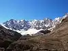
Anexo:Montañas de Irán
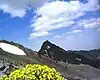
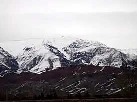
Este anexo lista, en forma de tabla, las montañas más destacadas de Irán. Irán no es un país absolutamente desíertico. Se trata de un país montañoso, de 1200 m s. n. m. de media, siendo la parte occidental la más montañosa, con cordilleras como los montes Zagros del noroeste al sureste) y los montes Elburz (en el norte). Más, el monte Damavand que está ubicado en la cordillera de Elburz es el monte más alto de Irán y es el volcán más alto de Asia. «https://www.nomadatrek.com/ascension-damavand/»
Cuatromiles de Irán
En este artículo se recoge una lista de todas las cumbres y cimas subsidiarias de una altitud de 4000 m o más sobre el nivel del mar en Irán. Dado que no existe una definición precisa o formal de cumbre o cima de una montaña, el número de cumbres de 4000 m es variable. La prominencia topográfica es un factor importante a la hora de decidir la nominación oficial de una cumbre. La lista se que recoge aquí se basa no sólo en la prominencia sino también en otros criterios, como la morfología (apariencia general) y el interés montañero. Un criterio de prominencia mínima de 300 m o incluso de 500 m reduciría considerablemente el número de cuatromiles.
La tabla muestra los cuatromiles en Irán.[1][2] Hay varias cumbres en la lista con múltiples picos, donde solo figura el más alto. El uso del descriptor Kooh/Kuh (monte) está incorporado en muchos de los orónimos usados en la cartografía digital.
Montañas más destacadas de Irán
- (Nota: La lista puede estar incompleta y ayudarías mejorándola)
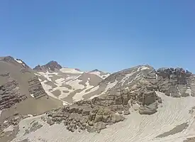
| Puntos culminantes | ||
| Provincia[3] | Cordillera | |
| Imagen | # (alt.) |
# (pro.) |
# (ais.) |
# | Tipo | Cumbre | (en persa) | Cordillera | Subcordillera | Provincia | Altitud (m) |
Prom. (m)[4][5] |
Aislamiento (km) |
Notas | Coordenadas |
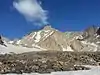
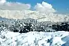
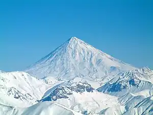 | 01 | 01 | ? | MAZ-01 | Monte Damavand | دماوند | Montes Elburz | Central | Mazandarán | 5610[6] | 4667 | Punto culminante de Irán, de Oriente Medio, de los montes Elburz y volcán más alto de Asia | 35°57′20″N 52°06′36″E | ||
 | 02 | 19 | ? | MAZ-02 | Alam Kuh | علم کوه | Montes Elburz | Macizo Tajt-e Soleimán | Mazandarán | 4826 | 1848 | 36°22′32″N 50°57′42″E | |||
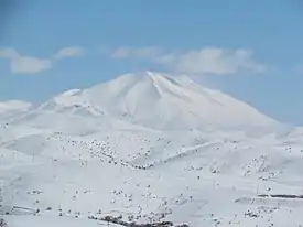
 | 03 | 02 | ? | ARD-01 | Sabalan | سبلان | Meseta iraní | Cordilleras noroccidentales | Ardebil | 4811 | 3283 | 346 | 38°16′1″N 47°50′13″E | ||
| ? | ? | ? | -? | — | Shākhak (5 picos) | شاخک | Montes Elburz | Macizo Tajt-e Soleimán | ? | 4795 | 36°22′29.36″N 50°58′6.09″E | ||||
| — | — | ? | MAZ-? | — | Monte Takht-e Suleyman (Takhté Soleyman) | تخت سلیمان | Montes Elburz | Macizo Tajt-e Soleimán | Mazandarán | 4665 | 281 | 36°23′26.45″N 50°57′33.67″E | |||
| ? | ? | ? | -? | Khersan Norte | خرسان شمالی | Montes Elburz | Macizo Tajt-e Soleimán | ? | 4680[7] | 36°22′6.22″N 50°57′14.18″E | |||||
| ? | ? | ? | -? | Khersan Sur | خرسان جنوبی | Montes Elburz | Macizo Tajt-e Soleimán | ? | 4659[7] | 36°21′53.29″N 50°57′7.14″E | |||||
| ? | ? | ? | -? | Siahsang (Siāh-Sang) | سیاه سنگ | Montes Elburz | Macizo Tajt-e Soleimán | ? | 4604 | 36°22′22.77″N 50°58′39.18″E | |||||
| ? | ? | ? | -? | — | Heram | هرم | Cordilleras Noroccidentales | Sabalan | 4587 | 345 | 38°15′16.7″N 47°48′49.9″E | ||||
| ? | ? | ? | -? | — | Marji-Kesh | مرجی کش | Montes Elburz | Macizo Tajt-e Soleimán | 4580 | 36°22′2.86″N 50°57′58.55″E | |||||
| — | — | ? | -? | — | Kasrā | کسری | Cordilleras Noroccidentales | Sabalan | 4577 | 137 | 38°15′10.8″N 47°48′19.5″E | ||||
| — | — | ? | -? | — | Haft Khan I[8] | هفت خوان | Montes Elburz | Macizo Tajt-e Soleimán | ? | 4539 | 130 | 36°22′16.80″N 50°56′17.66″E | |||
| — | — | — | MAZ— | Chaloon (Chāloun) | چالون | Montes Elburz | Macizo Tajt-e Soleimán | ? | 4511 | 103 | 36°22′56.97″N 50°59′25.84″E | ||||
| ? | ? | ? | -? | — | Siāh-Goog Sur (Siahgook)[9] | سیاه گوگ | Montes Elburz | Macizo Tajt-e Soleimán | ? | 4500 | 36°23′52.94″N 50°57′44.15″E | ||||
| ? | 04 | ? | KER-01 | Kuh-e Hazār (Kuh-e Hazaran) | هَزار | Cordillera Central Iraní | Macizo de Hazaran | Kermán | 4500[10] | 2741 | 29°30′42.1″N 57°16′17.9″E | ||||
 | — | — | — | MAZ— | Siah-Kaman | سیاه کمان | Montes Elburz | Macizo Tajt-e Soleimán | Mazandarán | 4472 | 107 | 36°23′30.4″N 50°59′27.1″E | |||
| ? | ? | ? | -? | — | Mish-Chāl | میش چال | Montes Elburz | Macizo Tajt-e Soleimán | 4470 | 36°24′5.75″N 50°57′43.69″E | |||||
 | — | — | — | MAZ— | Shaneh-Kuh | شانه کوه | Montes Elburz | Macizo Tajt-e Soleimán | Mazandarán | 4465 | 80 | 36°22′56.47″N 50°57′43.71″E | |||
| ? | ? | ? | -? | Siahgook Norte[11] | Montes Elburz | Macizo Tajt-e Soleimán | ? | 4486 | 51 | ||||||
| ? | ? | ? | -? | — | Rostam-Nisht | رستم نیشت | Montes Elburz | Macizo Tajt-e Soleimán | 4426 | 305 | 36°24′29.37″N 50°57′33.80″E | ||||
| ? | ? | ? | -? | Kaloo (Kalahoo)[12] | کالو | Montes Elburz | Macizo Tajt-e Soleimán | ? | 4412 | 345 | 36°26′44.87″N 50°56′55.95″E | ||||
 | ? | 05 | ? | ISF-01 | Monte Dena (Kuh-e Dinar) (Qash-Mastan) | Montes Zagros | Centromeridionales | Isfahán Kohkiluyeh y Buyer Ahmad Chahar Mahal y Bajtiarí | 4409 | 2604 | P.º cul. de los montes Zagros | ||||
| ? | ? | ? | -? | — | Nenoo (Laleh-Zār) | (لاله زار (ننو | Cordillera Central Iraní | Macizo Hazaran | 4403[13] | 540 | 29°24′09″N 56°48′51″E | ||||
| — | — | ? | -? | Gardoon kuh | گردون کوه | Montes Elburz | Macizo Tajt-e Soleimán | ? | 4402 | 113 | 36°20′34.40″N 50°57′30.71″E | ||||
| ? | ? | ? | KER-? | Kuh-e Shah (Lalehzar) | Montes Zagros | Kermán | 4400 | ||||||||
| ? | ? | ? | -? | — | Ghobi | قُبی | Montes Elburz | Macizo Tajt-e Soleimán | ? | 4399 | 36°26′54.06″N 50°56′31.54″E | ||||
| — | — | — | MAZ— | — | Gardunek Kuh | Montes Elburz | Macizo Tajt-e Soleimán | ? | 4397 | 127 | 36°20′35″N 50°57′31″E | ||||
| ? | ? | ? | -? | — | Kuhe'-Shāh (Kalleh-Barfi) | (کوه شاه (کله برفی | Cordillera Central Iraní | Macizo Hazaran | ? | 4392[13] | 1384 | 29°23′28″N 56°44′50″E | |||
| ? | ? | ? | -? | — | Kalāch-Band | کلاچ بند | Montes Elburz | Macizo Tajt-e Soleimán | ? | 4392 | 36°23′5.80″N 50°59′58.56″E | ||||
| — | — | ? | -? | — | Moor-Gol | مور گل | Montes Zagros | Montañas Dena | ? | 4380 | 243 | 30°57′44.00″N 51°25′26.00″E | |||
| ? | ? | ? | -? | — | Menār | منار | Montes Elburz | Macizo Tajt-e Soleimán | ? | 4378 | 36°21′6.13″N 50°57′39.06″E | ||||
 | ? | ? | ? | TEH-01 | Gran Kholeno | خُلنو بزرگ | Montes Elburz | Centrales | Teherán | 4375[14] | 740 | 36°3′52.96″N 51°33′6.94″E | |||
| ? | ? | ? | -? | Paloon Gardan | Montes Elburz | Centrales | ? | 4375 | |||||||
| — | — | ? | -? | — | Māsh (Bijan I) | ماش | Montes Zagros | Montañas Dena | 4370 | 232 | 30°55′57.00″N 51°28′11.00″E | ||||
 | ? | ? | ? | -? | — | Azād Kuh | آزادکوه | Montes Elburz | Macizo Kholeno | ? | 4355[14] | 960 | 53,74 | 36°10′9.00″N 51°30′8.00″E | |
| ? | ? | ? | -? | Nazer | Montes Elburz | Centrales | ? | 4350 | |||||||
| ? | ? | ? | -? | — | Yāprāgh | یاپراق | Cordilleras Noroccidentales | Sabalan | ? | 4350 | 38°16′40.1″N 47°50′01.8″E | ||||
| ? | ? | ? | -? | — | Pequeño Kholeno | خُلنو کوچک | Montes Elburz | Macizo Kholeno | ? | 4348 | 36°3′38.10″N 51°33′9.26″E | ||||
 | — | — | — | MAZ— | — | Miān-Seh-Chāl | میان سه چال | Montes Elburz | Macizo Tajt-e Soleimán | Mazandarán | 4348 | 153 | 36°23′11.53″N 50°58′29.09″E | ||
| ? | ? | ? | ?- | Kale Qodveis | Montes Zagros | Dena | ? | 4341 | 424 |
| |||||
| ? | ? | ? | -? | — | Seh-Ghoppeh-Āsemāni (Bijan II) | سه قپه آسمانی | Montes Zagros | Montañas Dena | ? | 4340 | 30°56′14.00″N 51°27′3.00″E | ||||
| ? | ? | ? | -? | — | Do-Khāharān Oeste | دوخواهران غربی | Montes Elburz | Macizo Do Khvaharan | ? | 4338 | 644 | 36°2′1.29″N 51°55′14.83″E | |||
| ? | ? | ? | -? | — | Tangeh-Geloo | تنگه گلو | Montes Elburz | Macizo Tajt-e Soleimán | ? | 4335 | 36°21′57.64″N 50°59′3.56″E | ||||
| ? | ? | ? | -? | — | Hezār-Cham | هزارچم | Montes Elburz | Macizo Tajt-e Soleimán | ? | 4317 | 36°20′20.83″N 50°57′45.70″E | ||||
| ? | ? | ? | -? | — | Harā Este | هرا شرقی | Montes Zagros | Montañas Dena | ? | 4310 | 30°55′20.51″N 51°29′0.65″E | ||||
| ? | ? | ? | -? | — | Do-Khāharān Este | دو خواهران شرقی | Montes Elburz | Macizo Do Khvaharan | ? | 4310 | 644 | 36°1′55.04″N 51°55′22.25″E | |||
| ? | ? | ? | -? | — | Ghāsh-Mastān (Bijan III) | قاش مستان | Montes Zagros | Montañas Dena | ? | 4312 | 30°57′6.00″N 51°26′10.00″E | ||||
| ? | ? | ? | -? | — | Heram | هرم | Montes Zagros | Montañas Dena | ? | 4305 | 100 | 30°56′39.12″N 51°26′57.12″E | |||
| ? | ? | ? | -? | — | Bon-Ro | بن رو | Montes Zagros | Montañas Dena | ? | 4300 | 30°56′43.60″N 51°26′11.02″E | ||||
| ? | ? | ? | -? | — | Loinā | لوی نا | Montes Elburz | Macizo Tajt-e Soleimán | ? | 4300 | 36°27′1.77″N 50°55′53.2″E | ||||
| ? | ? | ? | -? | — | Setāreh | ستاره | Montes Elburz | Macizo Tajt-e Soleimán | ? | 4296 | 36°21′24.92″N 50°57′24.84″E | ||||
| ? | ? | ? | -? | — | Abidar (Chahar Takht) | Montes Elburz | Macizo Tajt-e Soleimán | ? | 4286 | 503 | 36°22′36″N 51°3′55″E | ||||
| ? | ? | ? | -? | — | Borj | برج | Montes Elburz | Macizo Kholeno | ? | 4293 | 36°3′13.00″N 51°33′2.15″E | ||||
| ? | ? | ? | -? | — | Harā Oeste | هرا غربی | Montes Zagros | Montañas Dena | ? | 4280 | 30°55′16.80″N 51°28′40.26″E | ||||
| ? | ? | ? | -? | — | Kale'-Bolbol | کل بلبل | Montes Zagros | Montañas Dena | ? | 4280 | 371 | 31°3′9.50″N 51°20′49.51″E | |||
| ? | ? | ? | -? | — | Shekar-Loghās (Gran Nāzer) | شکر لقاس (ناظر بزرگ) | Montes Elburz | Macizo Do Khvaharan | ? | 4278 | 503 | 36°5′11.00″N 51°57′8.00″E | |||
| ? | ? | ? | -? | — | Harzeh-Kuh | هرزه کوه | Montes Elburz | Macizo Kholeno | ? | 4268 | 36°3′3.00″N 51°32′36.00″E | ||||
| ? | ? | ? | -? | — | Chapak-Roo | چپکرو | Montes Elburz | Macizo Do Khvaharan | ? | 4260 | 36°1′49.54″N 51°56′11.22″E | ||||
| ? | ? | ? | -? | — | Koleh-Gerdenak | کله گردنک | Montes Elburz | Macizo Tajt-e Soleimán | ? | 4260 | 36°23′33.04″N 51°0′26.99″E | ||||
| — | — | — | MAZ— | — | Gran Lashgarak | لشگرک بزرگ | Montes Elburz | Macizo Tajt-e Soleimán | Mazandarán | 4255 | 175 | 36°20′7.64″N 50°58′45.80″E | |||
| ? | ? | ? | -? | — | Paloon-Gardan | پالون گردن | Montes Elburz | Macizo Kholeno | ? | 4256 | 36°5′8.13″N 51°35′14.09″E | ||||
| ? | ? | ? | -? | — | Khers-Chāl | خرس چال | Montes Elburz | Macizo Kholeno | ? | 4253 | 36°3′16.00″N 51°32′19.00″E | ||||
| ? | ? | ? | -? | — | Mish-Chāl | میش چال | Montes Elburz | Macizo Kholeno | ? | 4253 | 36°4′7.70″N 51°33′44.46″E | ||||
| ? | ? | ? | -? | — | Pāzan-Pir (Pazane Pir) | پازن پیر | Montes Zagros | Montañas Dena | ? | 4250 | 1033 | 30°47′19.20″N 51°38′57.71″E | |||
| ? | ? | ? | -? | — | Ghezel-Gholleh | قزل قله | Montes Zagros | Montañas Dena | ? | 4250 | 30°56′27.04″N 51°26′51.19″E | ||||
| ? | ? | ? | -? | — | Abeedar | ابیدر | Montes Elburz | Macizo Tajt-e Soleimán | ? | 4250 | 473 | 36°22′35.6″N 51°03′53.9″E | |||
 | ? | ? | ? | QAZ-01 | Sialan | Montes Elburz | Occidentales | Qazvin | 4250 | ||||||
 | ? | ? | ? | -? | Monte Chlchama | Montes Zagros | Septentrionales | Provincia de | 4250 | ||||||
| ? | ? | ? | -? | — | Takhte'-Rostam | تخت رستم | Montes Elburz | Macizo Tajt-e Soleimán | ? | 4246 | 36°25′11.77″N 50°57′21.29″E | ||||
| ? | ? | ? | -? | — | Kamān-Kuh | کمان کوه | Montes Elburz | Macizo Kholeno | ? | 4234 | 518 | 36°7′46.28″N 51°28′13.84″E | |||
| ? | 25 | ? | -? | Kuh-e Palvar | پلوار | Cordillera Central Iraní | Hazaran | ? | 4233[15] | 1970 | 30°04′12.1″N 57°27′56.8″E | ||||
| ? | ? | ? | -? | — | Zard-Gel | زرد گل | Montes Elburz | Macizo Tajt-e Soleimán | ? | 4231 | 36°21′36.24″N 50°58′31.89″E | ||||
 | ? | 09 | ? | CHA-01 | Zard-Kuh (Kolunchin/Kolonchin) | کلون چین | Montes Zagros | Zard-Kuh | Chahar Mahal y Bajtiarí | 4221 | 2095 | 32°21′52.53″N 50°4′38.77″E | |||
| ? | ? | ? | ?- | Kuh-e Dama | Montes Zagros | Dena | ? | 4216 | 504 |
| |||||
| ? | ? | ? | -? | — | Farākheh-no | فراخه نو | Montes Elburz | Macizo Kholeno | ? | 4210 | 36°3′31.98″N 51°31′30.98″E | ||||
| ? | ? | ? | -? | — | Sarakchāl | سرکچال | Montes Elburz | Macizo Kholeno | ? | 4210 | 289 | 36°1′42.05″N 51°32′21.83″E | |||
| ? | ? | ? | -? | — | Kapiri | کپیری | Montes Zagros | Montañas Dena | ? | 4210 | 30°55′41.32″N 51°27′36.76″E | ||||
| ? | ? | ? | -? | — | Si-Yoneh-Zā | سی یونه زا | Montes Elburz | Macizo Kholeno | ? | 4208 | 36°04′09.6″N 51°32′52.1″E | ||||
| ? | ? | ? | -? | — | Narges | نرگس | Montes Elburz | Macizo Kholeno | ? | 4206 | 36°5′57.07″N 51°35′6.94″E | ||||
| ? | ? | ? | -? | — | Sar-Khar-Sang | سرخرسنگ | Montes Elburz | Macizo Kholeno | ? | 4203 | 36°4′44.28″N 51°33′49.71″E | ||||
| ? | ? | ? | -? | — | Asbi-Chāl | اسبی چال | Montes Elburz | Macizo Kholeno | ? | 4200 | 36°04′21.2″N 51°32′42.2″E | ||||
| ? | ? | ? | -? | — | Kale'-Sheydā | کل شیدا | Montes Zagros | Montañas Dena | ? | 4200 | 31°3′17.97″N 51°20′22.17″E | ||||
| ? | ? | ? | -? | — | Tal-Gardal | تل گردل | Montes Zagros | Montañas Dena | ? | 4200 | 30°58′51.58″N 51°23′25.86″E | ||||
| ? | ? | ? | -? | — | Ahrām-Lokooreh | اهرام لوکوره | Montes Zagros | Montañas Dena | ? | 4200 | 30°59′27.07″N 51°23′36.99″E | ||||
| ? | ? | ? | -? | Koloon Bastak | Montes Elburz | Centrales | ? | 4200 | |||||||
| ? | ? | ? | -? | — | Nefār-Neghār | نفار نقار | Montes Elburz | Macizo Tajt-e Soleimán | ? | 4199 | 36°25′57.14″N 50°57′8.77″E | ||||
| ? | ? | ? | -? | — | Zarin kuh (Zarrin-Kuh) | زرین کوه | Montes Elburz | Macizo Tajt-e Soleimán | ? | 4198 | 451 | 36°16′43.46″N 51°3′36.71″E | |||
| ? | ? | ? | -? | — | Yakh-Chāl | یخچال | Montes Elburz | Macizo Kholeno | ? | 4194 | 317 | 36°7′31.43″N 51°29′7.76″E | |||
| ? | ? | ? | -? | — | Kale'-Kharman | کل خرمن | Montes Zagros | Montañas Dena | ? | 4190 | 30°50′21.46″N 51°35′6.45″E | ||||
| ? | ? | ? | -? | — | Sar-Koule' | سرکوله | Montes Elburz | Macizo Do Khvaharan | ? | 4188 | 36°05′32.7″N 51°56′58.2″E | ||||
| ? | ? | ? | -? | — | Siālān | سیالان | Montes Elburz | Elburz Occidentales | ? | 4185 | 1164 | 36°30′41.89″N 50°41′54.63″E | |||
| ? | ? | ? | -? | — | Div-Chāl | دیوچال | Montes Elburz | Macizo Tajt-e Soleimán | ? | 4185 | 36°21′42.3″N 51°02′53.9″E | ||||
| ? | ? | ? | -? | — | Pequeño Lashgarak | لشگرک کوچک | Montes Elburz | Macizo Tajt-e Soleimán | ? | 4184 | 36°19′41.25″N 50°58′53.37″E | ||||
| ? | ? | ? | -? | — | Sichāni | سیچانی | Montes Zagros | Montañas Dena | 4180 | 30°53′46.00″N 51°29′42.00″E | |||||
| ? | ? | ? | -? | Khashechal | Montes Elburz | Occidentales | ? | 4180 | |||||||
| ? | ? | ? | MAZ-? | — | Zarrinkuh (Masechal) | Montes Elburz | Macizo Tajt-e Soleimán | Mazandarán | 4177 | 451 | 36°16′44″N 51°3′36″E | ||||
| ? | ? | ? | -? | — | Takhte'-Khers | تخت خرس | Montes Elburz | Macizo Do Khvaharan | ? | 4178 | 36°2′39.39″N 51°54′45.30″E | ||||
| ? | ? | ? | -? | — | Sar-Māhoo | سرماهو | Montes Elburz | Macizo Kholeno | ? | 4165 | 36°7′30.80″N 51°28′35.32″E | ||||
| ? | ? | ? | -? | — | Koloon-Bastak (Kolunbastak) | کلون بستک | Montes Elburz | Macizo Kholeno | ? | 4156 | 359 | 36°3′12.63″N 51°27′55.31″E | |||
| ? | ? | ? | -? | — | Siāh Ghār (Sarakchāl II) | سیاه غار | Montes Elburz | Macizo Kholeno | ? | 4152 | 36°1′43″N 51°31′59″E | ||||
| ? | ? | ? | -? | — | Ghebleh | قبله | Montes Zagros | Montañas Dena | ? | 4150 | 30°57′39.38″N 51°26′26.86″E | ||||
| ? | ? | ? | -? | — | Ghalāt'e-Bozi | قلات بزی | Montes Zagros | Montañas Dena | ? | 4150 | 31°0′25.21″N 51°22′32.10″E | ||||
| ? | ? | ? | -? | — | Kāhoo | کاهو | Montes Elburz | Macizo Do Khvaharan | ? | 4150 | 36°2′51.26″N 51°54′16.56″E | ||||
| ? | ? | ? | -? | — | Khersān | خرسان | Montes Zagros | Zard-Kuh | ? | 4150 | 32°22′12″N 50°04′58.4″E | ||||
| ? | ? | ? | -? | Sarakchal | Montes Elburz | Centrales | ? | 4150 | |||||||
| ? | ? | ? | -? | — | San-Borān | سن بران | Montes Zagros | Oshtorankuh | ? | 4139 | 1986 | 33°20′24.83″N 49°18′15.88″E | |||
 | ? | ? | ? | KER-? | — | Kuh-e Jupar (Jupār) | جوپار | Cordillera Central Iraní | Macizo Hazaran | Kermán | 4135[16] | 1597 | 29°54′39.0″N 57°12′06.1″E | ||
| ? | ? | ? | -? | — | Seh-Sang | سه سنگ | Montes Elburz | Macizo Do Khvaharan | ? | 4135 | 36°01′22.6″N 51°56′49.5″E | ||||
| ? | ? | ? | ?- | Chegaleh | Montes Zagros | Zard-Kuh | ? | 4134 | 594 | ||||||
| ? | ? | ? | -? | — | Dāl-Kowli | دال کولی | Montes Elburz | Macizo Kholeno | ? | 4130 | 36°4′4.70″N 51°30′7.08″E | ||||
| ? | ? | ? | -? | — | Chāle'-Vohli | چال وهلی | Montes Zagros | Montañas Dena | ? | 4130 | 31°2′0.14″N 51°21′9.57″E | ||||
| ? | ? | ? | -? | — | Pālvān | پالوان | Montes Elburz | Macizo Kholeno | ? | 4126 | 36°5′4.01″N 51°34′33.74″E | ||||
 | ? | ? | ? | ALB-? QAZ-01 | — | Shah Alborz | شاه البرز | Montes Elburz | Centrales | Elburz Qazvin | 4200 | 36°18′51.34″N 50°45′11.45″E | |||
| ? | ? | ? | -? | — | Band-Dāl-Koli | بند دال کولی | Montes Elburz | Macizo Kholeno | ? | 4118 | 36°3′44.97″N 51°30′59.15″E | ||||
| ? | ? | ? | -? | — | Kale'-Ghodveis | کل قدویس | Montes Zagros | Montañas Dena | ? | 4110 | 31°3′52.38″N 51°20′5.33″E | ||||
| ? | ? | ? | -? | — | Barf-Kermoo | برف کرمو | Montes Zagros | Montañas Dena | ? | 4110 | 30°51′50.85″N 51°33′3.47″E | ||||
| ? | ? | ? | -? | — | Barf-Chāl | برف چال | Montes Zagros | Montañas Dena | ? | 4110 | 30°46′54.06″N 51°39′15.50″E | ||||
| ? | ? | ? | -? | — | Central Lokooreh | لوکوره مرکزی | Montes Zagros | Montañas Dena | ? | 4110 | 31°0′12.50″N 51°23′28.02″E | ||||
| ? | ? | ? | -? | — | Yakh-Kamar | یخ کمر | Montes Elburz | Macizo Do Khvaharan | ? | 4110 | 36°2′41.14″N 51°54′54.57″E | ||||
| ? | ? | ? | -? | — | Kuh-e Naz (Nāz) | ناز | Montes Elburz | Macizo Kahar | ? | 4108 | 974 | 36°6′30.28″N 51°2′27.50″E | |||
| ? | ? | ? | ?- | Haft Tanan | Montes Zagros | Zard-Kuh | ? | 4104 | 653 | ||||||
| ? | ? | ? | -? | Varevasht | Montes Elburz | Centrales | ? | 4100 | |||||||
| ? | ? | ? | -? | Kharsang | Montes Elburz | Centrales | ? | 4100 | |||||||
| ? | ? | ? | -? | — | North Nevel | نول شمالی | Montes Zagros | Montañas Dena | ? | 4100 | 30°49′21.76″N 51°36′48.11″E | ||||
| ? | ? | ? | -? | — | Godāre'-Kaj-Andar-Kaj | گدار کج اندر کج | Cordillera Central Iraní | Macizo Hazaran | ? | 4100[13] | 29°26′8.7″N 56°46′4.9″E | ||||
| ? | ? | ? | -? | — | Golchin | گلچین | Cordillera Central Iraní | Macizo Hazaran | ? | 4093[15] | 30°01′17.4″N 57°31′01″E | ||||
| ? | ? | ? | -? | — | Māzi-Gardan | مازی گردن | Montes Elburz | Macizo Tajt-e Soleimán | ? | 4090 | 36°27′50.5″N 50°55′33.3″E | ||||
| ? | ? | ? | -? | — | Darvish-Kezli | درویش کزلی | Montes Zagros | Zard-Kuh | ? | 4086 | 32°17′6.66″N 50°8′28.74″E | ||||
| ? | ? | ? | -? | — | Gol-Gahar | گل گهر | Montes Zagros | Oshtoran Kuh | ? | 4084 | 33°20′23.77″N 49°17′48.69″E | ||||
| ? | ? | ? | -? | — | Koheno | کهنو | Montes Elburz | Macizo Kholeno | ? | 4082 | 36°7′15.33″N 51°29′38.66″E | ||||
| ? | ? | ? | -? | — | Mirzāei | میرزایی | Montes Zagros | Oshtoran Kuh | ? | 4081 | 33°20′9.93″N 49°18′21.54″E | ||||
 | ? | 16 | ? | LOR-01 | — | Oshtoran Kuh (Oshtorankuh) | سنبران | Montes Zagros | Centroseptentrionales | Provincia de Lorestán | 4081 | 1928 | 111,02 | 33°20′N 49°18′E | |
| ? | ? | ? | -? | — | Kole'-Kolāyo | کول کولایو | Montes Zagros | Oshtoran Kuh | ? | 4080 | 33°20′22.99″N 49°17′55.13″E | ||||
| ? | ? | ? | -? | — | Kelvān[17] | کلوان | Montes Elburz | Macizo Tajt-e Soleimán | ? | 4078 | 36°19′57.19″N 50°54′45.87″E | ||||
| ? | ? | ? | ?- | Qalikuh | Montes Zagros | ? | 4078 | 1420 | |||||||
| ? | ? | ? | -? | — | Kāoon (Kahoun) | کاعون | Montes Elburz | Macizo Do Khvaharan | ? | 4075 | 342 | 36°3′39.35″N 51°58′58.67″E | |||
| ? | ? | ? | -? | — | Koule' | کوله | Montes Elburz | Macizo Do Khvaharan | ? | 4074 | 36°4′41.41″N 51°56′36.36″E | ||||
| ? | ? | ? | -? | Pasand kuh | Montes Elburz | Macizo Tajt-e Soleimán | ? | 4074 | |||||||
| ? | ? | ? | -? | — | Do-Berār | دوبرار | Montes Elburz | Cresta Do-Berar | ? | 4072 | 1352 | 35°45′47.46″N 52°16′11.16″E | |||
| ? | ? | ? | -? | — | Haft-Tanan | هفت تنان | Montes Zagros | Zard-Kuh | ? | 4070 | 32°30′13.00″N 49°57′26.00″E | ||||
| ? | ? | ? | -? | — | Mish-Chāl | میش چال | Montes Elburz | Macizo Tajt-e Soleimán | ? | 4067 | 36°19′44.74″N 50°56′23.51″E | ||||
| — | — | — | LOR-? | — | Gol-Gol | گل گل | Montes Zagros | Oshtoran Kuh | Lorestán | 4060 | 120 | 1,46 | 33°20′38.72″N 49°17′19.57″E | ||
| ? | ? | ? | -? | — | Ghareh Dagh | قره داغ | Montes Elburz | Cresta Do-Berar | ? | 4057 | |||||
| ? | ? | ? | -? | — | Shir Kuh | شیرکوه | Cordillera Central Iraní | Cordillera Shir Kuh | ? | 4055 | 2271 | 31°36′21″N 54°04′06″E | |||
| ? | ? | ? | -? | — | Ālāneh-Sar | آلانه سر | Montes Elburz | Macizo Tajt-e Soleimán | ? | 4050 | 36°18′29.18″N 50°59′56.86″E | ||||
| ? | ? | ? | -? | — | Mishineh-no | میشینه نو | Montes Elburz | Macizo Kahar | ? | 4050 | 36°6′27.40″N 51°3′2.57″E | ||||
| ? | ? | ? | -? | — | Bard-Ātash | برد آتش | Montes Zagros | Montañas Dena | ? | 4050 | 30°53′57.40″N 51°30′59.46″E | ||||
| ? | ? | ? | -? | — | Nevel Sur | نِوِل جنوبی | Montes Zagros | Montañas Dena | ? | 4050 | 30°48′54.30″N 51°36′30.34″E | ||||
| ? | ? | ? | -? | — | Chary | چری | Montes Zagros | Zard-Kuh | ? | 4050 | 32°17′33″N 50°05′40.3″E | ||||
 | ? | 07 | ? | YAZ-01 | Shir Kuh (Shirkuh) | Meseta iraní | Central | Provincia de Yazd | 4050 | ||||||
| ? | ? | ? | -? | Kahar (montaña) | Montes Elburz | Occidentales | ? | 4050 | |||||||
| ? | ? | ? | -? | Alanehsar | Montes Elburz | Macizo Tajt-e Soleimán | ? | 4050 | |||||||
| — | — | — | MAZ— | — | Mishchal | Montes Elburz | Macizo Tajt-e Soleimán | Mazandarán | 4049 | 79 | 36°19′43″N 50°55′21″E | ||||
| ? | ? | ? | -? | — | Sar-Meshk | سرمِشک | Cordillera Central Iraní | Macizo Hazaran | 4048[16] | 709 | 29°22′32″N 57°11′21″E | ||||
| ? | ? | ? | -? | — | Nazar-Kuh | نظرکوه | Montes Elburz | Macizo Tajt-e Soleimán | ? | 4047 | 36°19′42.75″N 50°55′20.01″E | ||||
| ? | ? | ? | -? | — | Angemār | انگمار | Montes Elburz | Cresta Do-Berar | ? | 4044 | 35°46′4.67″N 52°12′46.01″E | ||||
| ? | ? | ? | -? | — | Chāte'-Sabz | چات سبز | Montes Zagros | Montañas Dena | ? | 4040 | 31°3′57.94″N 51°19′33.19″E | ||||
| ? | ? | ? | -? | — | Khoske'-Dar | خشکه در | Montes Elburz | Macizo Tajt-e Soleimán | ? | 4040 | 36°23′11.4″N 51°03′57.9″E | ||||
| ? | ? | ? | -? | — | Darreh-Khooni | دره خونی | Montes Elburz | Macizo Do Khvaharan | ? | 4039 | 36°2′52.63″N 51°52′39.23″E | ||||
| ? | ? | ? | ISF-? | — | Shāhān-Kuh (Shahankuh) | شاهان کوه [18] | Montes Zagros | Shahan-Kuh | Isfahán | 4038 | 1427 | 32°48′12.8″N 49°58′54.4″E | |||
| ? | ? | ? | -? | — | Varzāb | ورزاب | Montes Elburz | Macizo Kholeno | ? | 4036 | 36°2′50.64″N 51°34′55.68″E | ||||
| ? | ? | ? | -? | — | Shāh-Shahidan | شاه شهیدان | Montes Zagros | Zard-Kuh | ? | 4030 | 32°22′41″N 50°4′09″E | ||||
| ? | ? | ? | -? | — | Varavasht | وروشت | Montes Elburz | Centrales | ? | 4030 | 860 | 36°17′12.85″N 51°21′15.62″E | |||
| ? | ? | ? | -? | — | Kale'-Pāzani | کل پازنی | Montes Zagros | Montañas Dena | ? | 4020 | 31°3′57.94″N 51°19′33.19″E | ||||
| ? | ? | ? | -? | — | Kormā (Korma kuh o Kormakuh) | کرما | Montes Elburz | Macizo Tajt-e Soleimán | ? | 4009 | 345 | 36°27′24.39″N 51°0′16.49″E | |||
| — | — | — | -? | — | Fiyāleston | فیالستون | Montes Zagros | Oshtoran Kuh | ? | 4017 | 15 | 33°20′8.82″N 49°18′23.80″E | |||
| ? | ? | ? | -? | — | Kahār | کهار | Montes Elburz | Macizo Kahar | ? | 4015 | 36°7′2.00″N 51°5′6.00″E | ||||
| ? | ? | ? | ?- | Parchenan | Montes | ? | 4015 | 1144 |
| ||||||
| ? | ? | ? | -? | — | Tapoo | تپو | Montes Zagros | Montañas Dena | ? | 4010 | 30°48′8.84″N 51°37′50.57″E | ||||
| ? | ? | ? | -? | — | Haft-Sarān | هفت سران | Montes Elburz | Macizo Do Khvaharan | 4007 | 36°3′34.23″N 51°55′45.55″E | |||||
| ? | ? | ? | TEH-? | — | Sāt (Saat) | سات | Montes Elburz | Shah-Alborz | Teherán | 4003 | 428 | 36°17′44.11″N 50°49′12.46″E | |||
| ? | ? | ? | -? | — | Pasande'-Kuh | پسنده کوه [19] | Montes Elburz | Macizo Tajt-e Soleimán | 4000 | 36°24′6.74″N 51°1′0.52″E | |||||
| ? | ? | ? | -? | — | Māshel-no | ماشل نو | Montes Elburz | Macizo Tajt-e Soleimán | ? | 4000 | 36°23′56.30″N 51°0′41.52″E | ||||
| ? | ? | ? | -? | — | Sar-Dasht | سردشت | Montes Elburz | Macizo Tajt-e Soleimán | ? | 4000 | 36°21′29.52″N 50°58′55.07″E | ||||
| ? | ? | ? | ?- | Qanbarkosh | Montes Zagros | ? | 3982 | 316 | |||||||
| ? | ? | ? | -? | Siahleiz | Montes Elburz | Macizo Tajt-e Soleimán | ? | 3975 | |||||||
| ? | ? | ? | ?- | Cheshmeh Kuhrang | Montes Zagros | ? | 3969 | 360 | |||||||
| ? | ? | ? | ?- | Karpush | Montes Zagros | ? | 3961 | 915 |
| ||||||
| ? | 45 | ? | FAR-01 | Montaña Bel (Kuh-e Bul) | Montes Zagros | Centromeridionales | Fars | 3943 | 1563 | ||||||
 | ? | ? | ? | TEH-? | Tochal | Montes Elburz | Centrales | Teherán | 3942 | 1164 | 23,26 | ||||
 | ? | 03 | ? | SIS-01 | Kuh-i-Taftán (Tafatan) | Montañas de Baluchistán | Sistán y Baluchistán | 3941 | 2901 |
| |||||
| ? | 47 | ? | CHA-? | Kuh-e Gereh (Haft Cheshmeh) | Montes Zagros | Centromeridionales | Chahar Mahal y Bajtiarí | 3990 | 1557 |
| |||||
| ? | 17 | ? | SEM-01 | Kuh-e Shahvar | Montes Elburz | Orientales | Semnan | 3932 | 1923 | ||||||
| ? | ? | ? | -? | Mehrchal | Montes Elburz | Centrales | ? | 3920 | |||||||
| ? | ? | ? | ISF-? | Dalankuh | Montes Zagros | Isfahán | 3915 | ||||||||
| ? | ? | ? | ?- | Khurbeh | Montes Zagros | ? | 3902 | - | |||||||
| ? | ? | ? | ?- | Darab Shah | Montes Zagros | ? | 3900 | 1495 | - | ||||||
| ? | ? | ? | ?- | Piaro Kamandan | Montes Zagros | ? | 3891 | 370 | |||||||
| ? | 38 | ? | CHA-? | Kuh-e Hezar Darreh | Montes Zagros | Centromeridionales | Chahar Mahal y Bajtiarí | 3880 | 1620 | ||||||
 | ? | 30 | ? | ISF-? | Monte Karkas | Meseta iraní | Montañas Karkas | Isfahán | 3870 | 1698 | |||||
| ? | ? | ? | ?- | Kuh-e Hashtad | Montes Zagros | ? | 3869 | 1248 |
| ||||||
| ? | 25 | ? | KER-? | Kuh-e Khabr | Meseta Central Iraní | Kermán | 3856 | 1758 | |||||||
| ? | ? | ? | MAR-01 | Atash Kuh | Montes Elburz | Centrales | Markazi | 3850 | |||||||
| ? | ? | ? | -? | Shah Neshin (montaña) | Montes Elburz | Centrales | ? | 3850 | |||||||
| ? | ? | ? | ?- | Chahardah Pahlu | Montes Zagros | ? | 3845 | 949 | |||||||
| ? | ? | ? | GOL-01 | Gavkoshan | Montes Elburz | Golestán | 3840 | 1160 | |||||||
| ? | ? | ? | ?- | Dome Qalikuh | Montes Zagros | ? | 3839 | 602 | |||||||
| ? | ? | ? | ?- | Kule Jonou | Montes Zagros | ? | 3823 | 422 | |||||||
| ? | ? | ? | GUI-01 | Gavkoshan | Montes Elburz | Guilán | 3703 | ||||||||
| ? | 36 | ? | KER-? | Kuh-e Bagh-e Bala (Baghe Bala) | Meseta Central iraní | Hazaran | Kermán | 3775 | 1635 | ||||||
| ? | 51 | ? | JUZ-01 | Kuh-e Menar (Monar) | Montes Zagros | Centroseptentrionales | Juzestán | 3750 | 1510 | ||||||
| ? | 51 | ? | SEM-? | Kuh-e Nozva (Neyzeva) | Montes Elburz | Semnan | 3730 | 1510 | |||||||
 | ? | 22 | ? | AZOr-01 | Sahand | Cordillera Central Iraní | Azerbaiyán Oriental | 3707 | 1826 | ||||||
| ? | ? | ? | -? | Sataple | Montes Zagros | ? | 3669 | ||||||||
| ? | 39 | ? | CHA-? | Kuh-e Rag | Montes Zagros | Centromeridionales | Chahar Mahal y Bajtiarí | 3661 | 1609 | ||||||
| ? | 23 | ? | HAM-? LOR-? | Pico Velash, pto. cul. de la montaña Garin | Montes Zagros | Septentrionales | Hamadán Lorestán | 3623 | 1780 | ||||||
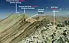
.jpg.webp) | ? | 43 | ? | AZoc-? | Cheekha Dar | Montes Zagros | Septentrionales | Azerbaiyán Occidental | 3611 | 1575 | Compartido con Iraq, donde es el punto culminante. | ||||
| ? | ? | ? | -? | Montes Elburz | Montes Elburz | Occidentales | ? | 3609 | |||||||
| ? | 42 | ? | KER-? | Kuh-e Mohammadabad | Meseta iraní | Central | Kermán | 3592 | 1585 | ||||||
| ? | ? | ? | ?- | Ghadamgah | Montes | ? | 3563 | 1057 | |||||||
| ? | ? | ? | ?- | Mafarun (n.º 31) | Montes Zagros | Centroseptentrionales | Chahar Mahal y Bajtiarí Juzestán | 3480 | 1688 | ||||||
 | ? | ? | ? | -? | Shaho | Montes Zagros | Centrales | ? | 3390 | ||||||
| ? | 26 | ? | AZoc-? KUR-? | Kuhe Haji Ebrahim | Montes Qandil, montes Zagros | Septentrionales | Azerbaiyán Occidental Kurdistán | 3587 | 1747 | Compartido con Iraq | |||||
 | ? | 34 | ? | HAM-01 | Alvand Kuh | Montes Zagros | Septentrionales | Hamadán | 3586 | 1670 | |||||
 | ? | 06 | ? | SIS-? | Kuh-i-Bazmán | Montes Zagros | Sistán y Baluchistán | 3490 | 2400 | ||||||
| ? | ? | ? | MAR-01 | Ardehal | Central Iranian Plateau | Markazi | 3460 | ||||||||
 | ? | 20 | ? | KEh-01 | Pico Glaciar ptº. culminante de la montaña Paraw | Montes Zagros | Septentrionales | Kermanshah | 3360 | 1833 |
| ||||
| ? | 55 | ? | AZOr-? | Kiyamaki Dagh | Cordillera Noroccidentales Iranís Cáucaso Menor | Azerbaiyán Oriental | 3358 | 1500 | |||||||
.jpg.webp) | ? | ? | ? | ISF-? | Tsikhe | Montes Zagros | Isfahán | 3350 | |||||||
| ? | 28 | ? | -? | Kuh-e Shahu | Montes Zagros | ? | 3350 | 1714 | |||||||
| ? | ? | ? | ZAN-01 | Belqeys | Cordilleras noroccidentales de Irán | Zanyán | 3332 | ||||||||
| ? | 37 | ? | ARD-? | Kuh-e Aq Dagh (Agh Dagh) | Montes Elburz | Ardebil | 3321 | 1625 | |||||||
| ? | 18 | ? | JORr-01 | Shirbad | Eastern Iranian Ranges | Jorasán Razaví | 3314 | 1870 | |||||||
| ? | 22 | ? | -? | Kuh-e Siah Khvani | Montes Elburz | ? | 3314 | 2074 | |||||||
| ? | ? | ? | AZOr-01 | Evrin | Anatolia Suroriental | Azerbaiyán Oriental | 3623 | * | |||||||
| ? | ? | ? | ?- | Shahdar Kuh | Montes | ? | 3252 | 1107 | |||||||
 | ? | ? | ? | HAM-? | Qezel Arsalan | Montes Zagros | Hamadán | 3250 | |||||||
| ? | 10 | ? | HOM-01 | Kuh-e Fareghan | Montes Zagros | Meridionales | Hormozgan | 3240 | 2082 | ||||||
| ? | ? | ? | QOM-01 | Barf Anbar | Central Iranian Plateau | Qom | 3220 | ||||||||
 | ? | ? | ? | JORr-? | Monte Binalud | Montes Elburz | Centrales | Jorasán Razaví | 3211 | ||||||
| ? | ? | ? | ?- | Badleh Kuh | Montes | ? | 3203 | 1036 | |||||||
| ? | 15 | ? | -? | Kuh-e Hami (Khami) | Montes Zagros | ? | 3190 | 1944 | |||||||
| ? | 27 | ? | YAZ-? | Kuh-e Kharanaq | Meseta iraní | Central | Yazd | 3150 | 1732 | ||||||
| ? | ? | ? | KUR-01 | Chehel Cheshmeh | Montes Zagros | Septentrionales | Kurdistán | 3140 | |||||||
| ? | 24 | ? | JORr-? | Kuhha-ye Hezar Masjed | Montes Elburz | Jorasán Razaví | 3120 | 1760 | |||||||
| ? | ? | ? | ?- | Kuhsefid (n.º 51) | Montes Zagros | Centromeridionales | Kohkiluyeh y Buyer Ahmad | 3120 | 1510 | ||||||
| ? | 63 | ? | -? | Kuh-e Raziyeh | Montes Zagros | ? | 3120 | 1510 | |||||||
| ? | 54 | ? | JORn-? | Kuh-e Patu (Aladagh) | Montes Elburz | Jorasán del Norte | 3070 | 1509 | |||||||
| ? | ? | ? | JORn-01 | Aladagh | Eastern Iranian Ranges | Jorasán del Norte | 3070 |
| |||||||
| ? | 41 | ? | -? | Kuh-kansifi | Montes Zagros | ? | 3065 | 1697 | |||||||
| ? | 49 | ? | SIS-? | Geli Kuh | Irán oriental | Provincia de Sistán y Baluchistán | 2995 | 1534 | |||||||
| ? | 44 | ? | HOM-? | Kuh-e Ja'in | Montes Zagros | Meridionales | Hormozgan | 2980 | 1572 | ||||||
| ? | 33 | ? | KUR-? | Kuh-e Takht | Montes Zagros | Septentrionales | Kurdistán | 2975 | 1675 | ||||||
| ? | 12 | ? | JORs-? | Kuh-e Nay Band (Nayband) | Meseta iraní | Central | Jorasán del Sur | 2960 | 1968 | ||||||
| ? | 46 | ? | JORr-? | Molkooh (Molkuh) | Irán oriental | Cordilleras orientales iranís | Jorasán Razaví | 2958 | 1560 | ||||||
| ? | 29 | ? | JORr-? | Kuh-e Gar | Irán oriental | Cordilleras orientales iranís | Jorasán Razaví | 2950 | 1710 | ||||||
| ? | 21 | ? | JORs-? | Shotori, Punto culminante de la cordillera Eshdeger | Irán oriental | Cordilleras orientales iranís | Jorasán del Sur | 2920 | 1830 | ||||||
| ? | 32 | ? | JORs-? | Mila Kuh (Shaskuh) | Irán oriental | Jorasán del Sur | 2888 | 1686 | |||||||
| ? | 35 | ? | JORs-? | Kuh-e Mirza 'Arab | Irán oriental | Cordilleras orientales iranís | Jorasán del Sur | 2887 | 1657 | ||||||
| ? | 40 | ? | FAR-? | Kuh-e Namak | Montes Zagros | Fars | 2846 | 1601 | |||||||
| ? | ? | ? | ILA-01 | Kabirkuh | Montes Zagros | Septentrionales | Ilam | 2810 | |||||||
| ? | 48 | ? | KER-? | Kuh-e Denband | Meseta iraní | Kermán | 2777 | 1539 | |||||||
| ? | ? | ? | -? | Montaña Birk | Montes Zagros | ? | 2740 | ||||||||
| ? | 08 | ? | KER-? | Kuh-e Shab | Montes Zagros | Kermán | 2681 | 2100 | |||||||
| ? | ? | ? | BUS-01 | Beyrami | Montes Zagros | Meridionales | Bushehr | 1960 | |||||||
| ? | 14 | ? | HOM-? | Poshtkuh (Khvoshkuh) | Montes Zagros | Meridionales | Hormozgan | 2650 | 1967 | ||||||
| ? | 11 | ? | -? | Kuh-e Genu | Montes Zagros | ? | 2350 | 2035 | |||||||
| ? | 50 | ? | -? | Kuh-e Par-e Lavar | Montes Zagros | ? | 2209 | 1530 | |||||||
| ? | ? | ? | -? | Sharbak | Montes Elburz | Centrales | ? | 1694 |
|
Véase también
- List of volcanoes in Iran
- List of Iranian four-thousanders
Notas
- «Detailed Map of Central Alborz Mountains : Photos, Diagrams & Topos : SummitPost». Summitpost.org. Consultado el 2 de octubre de 2018.
- «Iran JOG Series 1501 Index Map - Perry–Castañeda Map Collection - UT Library Online». Lib.utexas.edu. Consultado el 2 de octubre de 2018.
- Se resaltan los picos más altos de las provincias de Irán, recogidos de: «Iran Province High Points»
- «Iran Mountain Ultra-Prominence – peaklist.org». Peaklist.org. Consultado el 2 de octubre de 2018.
- «Google Fusion Tables». Fusiontables.google.com. Consultado el 2 de octubre de 2018.
- Damavand at Peakbagger.com, Kuh-e Damavand at peaklist.org
- «There are four summits in Khersan ridge named from north to south as North Khersan, Middle Khersan, Viraneh-Kuh and South Khersan but just the first and the last is named in the list». Summitpost.org. Consultado el 2 de octubre de 2018.
- El Haft Khan tiene una cresta con un total de 22 picos que superan los 4000 m. Destacan el Haft Khan I y el Haft Khan V.
- «Hezar». Peakbagger.com. Consultado el 2 de octubre de 2018.
- El Siahgook Norte tiene muy cerca el Siahgook Sur, un poco más alto, con 4491 m y respecto al que tiene una prominencia de apenas 51 m según la cartografía de Open Topo Map disponible en Open Street Map. Siahgook Sur tiene poca prominneica, 76 m, respecto al propio Takhte Soleymen.
- Kalahoo is not correct name for this mountain and is wrongly indicated in some documents!
- «Scale 1:250,000, Sirjan, Iran, Sheet NH 40-10» (JPG). Lib.utexas.edu. Consultado el 2 de octubre de 2018.
- «Scale 1:250,000, Amol, Iran, Sheet NJ 39-15» (JPG). Lib.utexas.edu. Consultado el 2 de octubre de 2018.
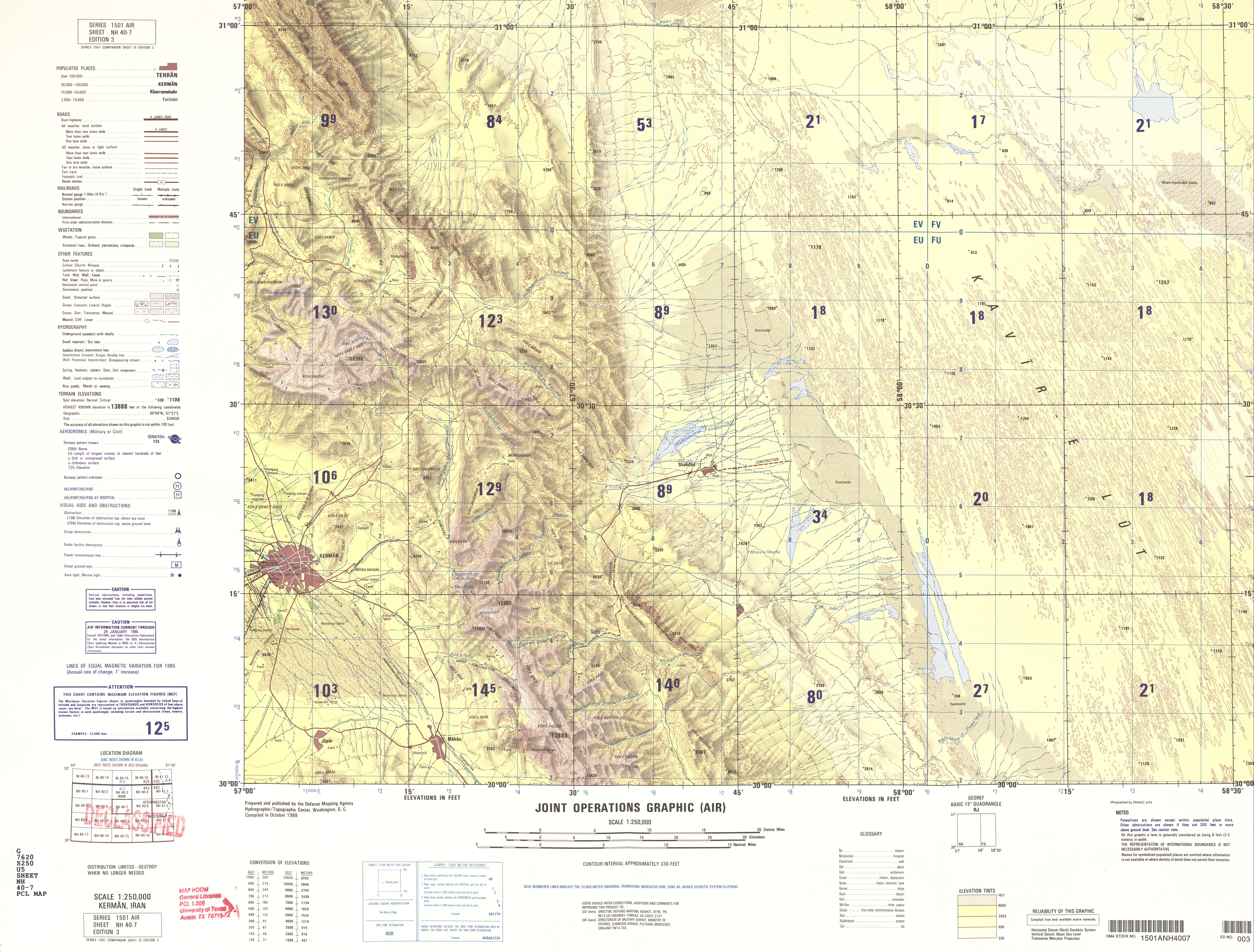
- «Scale 1:250,000, Kerman, Iran, Sheet NH 40-7» (JPG). Lib.utexas.edu. Consultado el 2 de octubre de 2018.
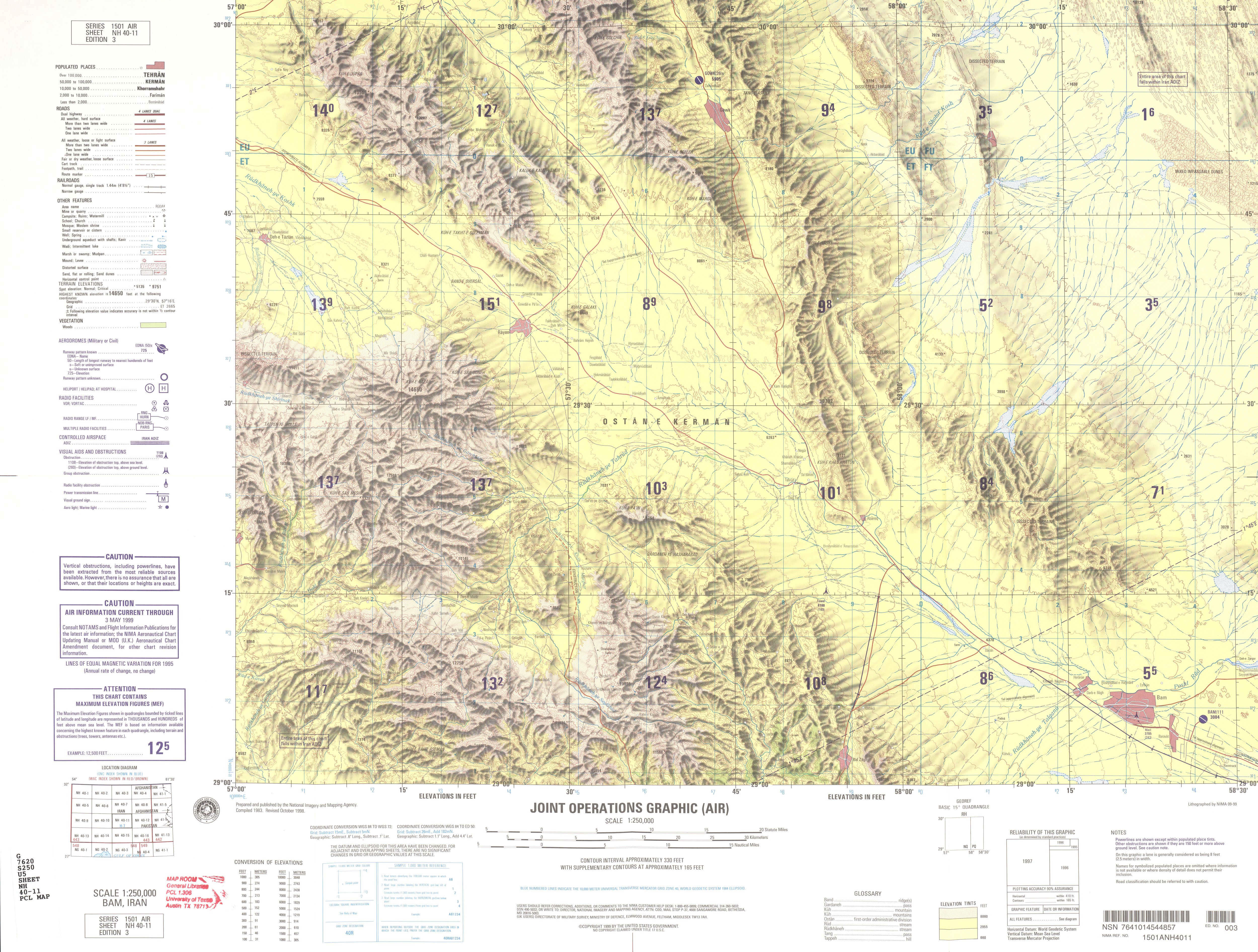
- «Scale 1:250,000, Bam, Iran, Sheet NH 40-11» (JPG). Lib.utexas.edu. Consultado el 2 de octubre de 2018.
- Hay otras cumbres Kelvan, Kelvan2 (4040 m), Kelvan 3 (4023 m) y Kelvan 4 (4050 m).
- «شاهان کوه 4038 متر». Archivado desde el original el 3 de marzo de 2014. Consultado el 3 de marzo de 2014. Parámetro desconocido
|url-status=ignorado (ayuda) - «پسنده کوه 4000 متر». Archivado desde el original el 3 de marzo de 2014. Consultado el 3 de marzo de 2014. Parámetro desconocido
|url-status=ignorado (ayuda)
Referencias
- Esta obra contiene una traducción derivada de «list of mountains in Iran» de Wikipedia en inglés, publicada por sus editores bajo la Licencia de documentación libre de GNU y la Licencia Creative Commons Atribución-CompartirIgual 4.0 Internacional.
 Portal:Asia. Contenido relacionado con Asia.