Distrito de Lalitpur
El distrito de Lalitpur es un distrito de Nepal.
| Distrito de Lalitpur | ||
|---|---|---|
| Distrito | ||
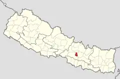 | ||
| Coordenadas | 27°40′00″N 85°19′00″E | |
| Capital | Patan | |
| Idioma oficial | Nepalí | |
| Entidad | Distrito | |
| • País |
| |
| Superficie | ||
| • Total | 350 km² | |
| Población (2011) | ||
| • Total | 468 132 hab. | |
| • Densidad | 1337,52 hab./km² | |
Geografía y clima
| Zona climática[1] | Rango de elevación | % de Área |
|---|---|---|
| Tropical superior | 300 a 1000 m 1000 a 3300 pie. |
9,9% |
| Subtropical | 1000 a 2000 m 3300 a 6600 pie. |
79,3% |
| Templado | 2000 a 3000 m 6400 a 9800 pie. |
10,8% |
Demografía
| Censo de población | ||
|---|---|---|
| Año | Pob. | ±% a. |
| 1981 | 184 341 | — |
| 1991 | 257 086 | — |
| 2001 | 337 785 | — |
| 2011 | 468 132 | — |
| 2021 | 548 401 | — |
| Fuente: Citypopulation.de[2] | ||
División administrativa
- Patan
- Mahalaxmi
- Godawari
- Konjyosom
- Bagmati
- Mahankal
Localidades
- Ashrang
- Badikhel
- Bhardev
- Bhattedanda
- Bisankhunarayan
- Bukhel
- Bungamati
- Chandanpur
- Chapagaun
- Chhampi
- Choughare
- Dalchoki
- Devichour
- Dhapakhel
- Dhusel
- Dukuchhap
- Gimdi
- Godamchaur
- Godawari
- Gotikhel
- Harisiddhi
- Ikudol
- Imadol
- Jharuwarasi
- Kaleswor
- Khokana
- Lamatar
- Lele
- Lubhu
- Malta
- Manikhel
- Nallu
- Pyutar
- Sainbu
- Sankhu
- Siddhipur
- Sunakothi
- Thaiba
- Thecho
- Thuladurlung
- Tikathali
Referencias
- The Map of Potential Vegetation of Nepal - a forestry/agroecological/biodiversity classification system, . Forest & Landscape Development and Environment Series 2-2005 and CFC-TIS Document Series No.110., 2005, ISBN 87-7903-210-9, consultado el 22 de noviembre de 2013.
- «NEPAL: Administrative Division». www.citypopulation.de (en inglés).
| Control de autoridades |
|
|---|
 Datos: Q1108338
 Multimedia: Lalitpur District, Nepal / Q1108338
Este artículo ha sido escrito por Wikipedia. El texto está disponible bajo la licencia Creative Commons - Atribución - CompartirIgual. Pueden aplicarse cláusulas adicionales a los archivos multimedia.